Climate sensitivity of water use by riparian woodlands at landscape scales

Mayes, M., et al. (2020) “Climate sensitivity of water use by riparian woodlands at landscape scales”, Hydrological Processes, doi:10.1002/hyp.13942.
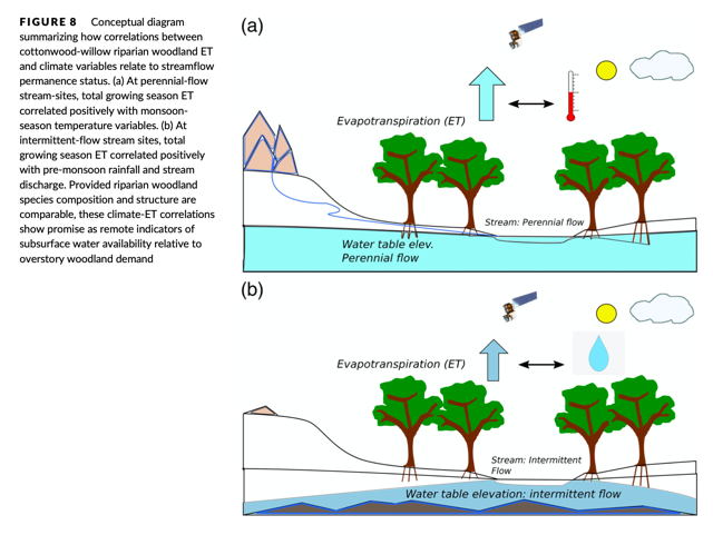
Abstract:Semi‐arid riparian woodlands face threats from increasing extractive water demand and climate change in dryland landscapes worldwide. Improved landscape‐scale understanding of riparian woodland water use (evapotranspiration, ET) and its sensitivity to climate variables is needed to strategically manage water resources, as well as to create successful ecosystem conservation and restoration plans for potential climate futures. In this work, we assess the spatial and temporal variability of Cottonwood (Populus fremontii)‐Willow (Salix gooddingii) riparian gallery woodland ET and its relationships to vegetation structure and climate variables for 80 km of the San Pedro River corridor in southeastern Arizona, USA, between 2014 and 2019. We use a novel combination of publicly available remote sensing, climate and hydrological datasets: cloud‐based Landsat thermal remote sensing data products for ET (Google Earth Engine EEFlux), Landsat multispectral imagery and field data‐based calibrations to vegetation structure (leaf‐area index, LAI), and open‐source climate and hydrological data. We show that at landscape scales, daily ET rates (6–10 mm day−1) and growing season ET totals (400–1,400 mm) matched rates of published field data, and modelled reach‐scale average LAI (0.80–1.70) matched lower ranges of published field data. Over 6 years, the spatial variability of total growing season ET (CV = 0.18) exceeded that of temporal variability (CV = 0.10), indicating the importance of reach‐scale vegetation and hydrological conditions for controlling ET dynamics. Responses of ET to climate differed between perennial and intermittent‐flow stream reaches. At perennial‐flow reaches, ET correlated significantly with temperature, whilst at intermittent‐flow sites ET correlated significantly with rainfall and stream discharge. Amongst reaches studied in detail, we found positive but differing logarithmic relationships between LAI and ET. By documenting patterns of high spatial variability of ET at basin scales, these results underscore the importance of accurately accounting for differences in woodland vegetation structure and hydrological conditions for assessing water‐use requirements. Results also suggest that the climate sensitivity of ET may be used as a remote indicator of subsurface water resources relative to vegetation demand, and an indicator for informing conservation management priorities.
